EXIF Geotags: Does Your Photo Reveal Your Location?
Unmasking Photo Geotags: Understand Risks & How to Check Location Data
Every photo you take can tell a story, not just through its visuals, but also through hidden data like EXIF geotags. What are EXIF geotags, and more importantly, does my photo reveal my location without me realizing it? This in-depth guide will help you unmask photo geotag information, understand the associated geotag privacy risks, and show you how to easily check photo location data, potentially using a user-friendly online EXIF data tool to inspect your own images.
What Exactly Are EXIF Geotags? Understanding Photo Location Data
To manage your photo location data effectively, you first need to understand what EXIF geotags are. Many users are surprised to learn how much location-specific information can be embedded in their pictures.

How Geotags Work: GPS Coordinates in Your EXIF
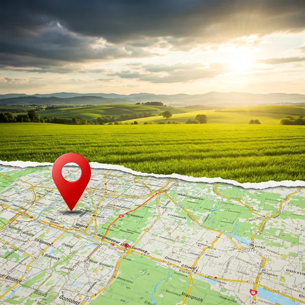
At their core, EXIF geotags are pieces of data that store the geographical location where a photo was taken. This information is typically recorded as GPS coordinates – specifically, latitude and longitude. Some devices might even record altitude. This EXIF GPS data is embedded directly into the image file's metadata.
Devices That Add Geotags: Smartphones, Cameras, and More
Most modern smartphones are equipped with GPS capabilities and, by default, will embed geotags into photos unless this feature is turned off. Many dedicated digital cameras, especially higher-end models and those with built-in GPS or connectivity to GPS-enabled devices, also add photo geotag information.
The Role of Location Services
For a device to add geotags, its location services (often referred to as GPS) must be enabled for the camera application. If you've disabled location services entirely or specifically for your camera app, geotags generally won't be recorded.
The Double-Edged Sword: Benefits and Privacy Risks of Geotags
EXIF geotags offer both advantages and significant disadvantages, particularly concerning geotag privacy.
The Upside: Organizing Memories, Photo Mapping, and More
Geotags can be incredibly useful for personal photo mapping and organizing memories. Imagine easily finding all photos from a specific vacation spot or automatically sorting pictures by location. For travelers and those meticulous about archiving, this exif data location can be a boon.
The Downside: Unintended Location Disclosure and Security Threats
However, the privacy risks of geotags are substantial. If you share a photo with its geotag intact, you're essentially broadcasting the exact GPS coordinates of where that photo was taken. This can lead to unintended location disclosure, potentially revealing your home, workplace, children's school, or daily routines to anyone who accesses the photo and knows how to view photo coordinates. This poses security threats from simple embarrassment to more serious concerns like stalking or targeted theft (e.g., knowing when you're away from home).
Real-World Examples of Geotag Privacy Concerns
There have been numerous instances where geotag privacy concerns became very real. Celebrities have had their locations inadvertently revealed, and even everyday users have faced issues when private location data from online sharing risks fell into the wrong hands. Understanding these risks helps emphasize why it's crucial to know how to find photo location data in your own images.
How to Check if Your Photos Contain Geotags
The first step in managing your photo geotag data is learning how to check photo location information. How to check photo location data? It's often easier than you think.
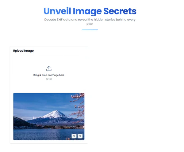
Using an Online EXIF Viewer like exifreader.org to See GPS Data
One of the simplest methods is to use an online EXIF viewer. A good geotag viewer tool will parse the image file (ideally without uploading it to a server, for maximum privacy) and display all the EXIF data, including any embedded EXIF GPS information.
How to View Photo Coordinates with exifreader.org
Using a tool like an online EXIF data service is straightforward:
- Visit the website.
- Upload or drag-and-drop your image into the designated area.
- The tool will process the image in your browser and display the EXIF data. Look for sections labeled "GPS," "Location," or similar, which will show the latitude, longitude, and possibly altitude.
Interpreting Geotag Information: Latitude, Longitude, and Altitude
The GPS coordinates are usually presented as decimal degrees or degrees, minutes, and seconds. Latitude indicates the north-south position, and longitude indicates the east-west position. Altitude refers to the height above sea level. Many online map services allow you to input these coordinates to see the exact location on a map.
Managing Your Geotag Data: How to Remove EXIF Location Information
Once you know how to find photo location data, you might decide you want to remove exif location information for privacy. How to remove location from photos?
Why You Might Want to Remove Geotags Before Sharing
As discussed, the primary reason to remove geotags is to protect your privacy and prevent unintended location disclosure when engaging in online sharing risks. It gives you control over what personal information accompanies your images.
Methods for Geotag Removal: Software, Online Tools, and In-Camera Settings
There are several geotag removal methods:
- Desktop Software: Many photo editing programs (e.g., Adobe Lightroom, GIMP) have options to strip EXIF data or specifically remove location information.
- Online Tools: Various online tools are dedicated to removing EXIF data, including geotags.
- In-Camera/Phone Settings: Some devices allow you to remove location data from photos already taken, or you can prevent it from being recorded in the first place (see below).
Using an EXIF Editor or Remover
An EXIF editor or EXIF remover tool (whether online or desktop) will typically allow you to select the photo and then choose to strip all EXIF data or selectively remove geotags. If you're using an online service for this, ensure it processes files securely. Before attempting removal, it's always wise to first view the EXIF data to understand what's there.
Proactive Privacy: Preventing Geotags from Being Recorded
The best way to manage geotag privacy is often to prevent the exif data location from being recorded at all.
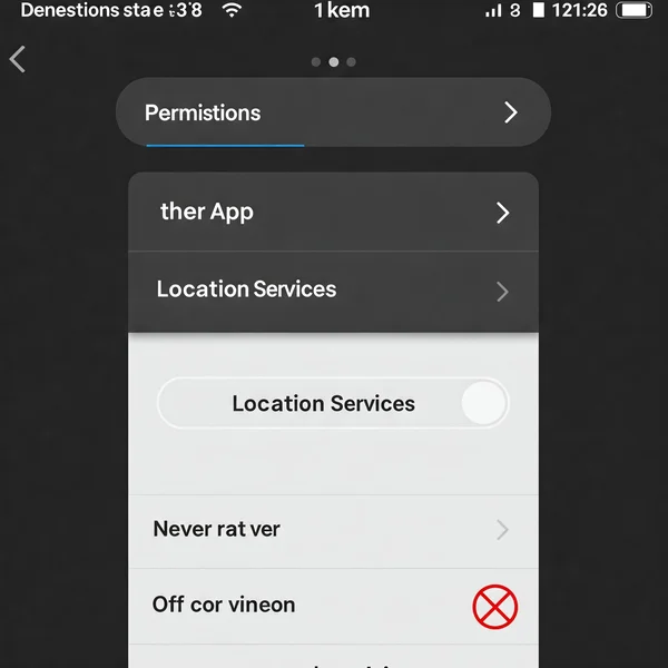
How to Disable Location Services for Your Camera App (iOS & Android)
On both smartphones (iOS and Android), you can go into your device's settings and disable location services for the camera app specifically, or turn off location services altogether. This will stop new photos from having geotags.
Checking Your Dedicated Camera's GPS Settings
If you use dedicated cameras, check their manuals for instructions on how to disable any built-in GPS functionality or connected EXIF GPS logging features.
Be Smart About Your Photo Location Data: View, Understand, and Control
Your photos are a window to your world, but they don't need to give away your exact coordinates. Understanding EXIF geotags, how to view photo coordinates, and the importance of managing this photo location data empowers you to share more safely. By taking a moment to check and, if necessary, remove exif location information, you can significantly enhance your geotag privacy.
Curious about what your photos reveal? Use an online photo metadata inspector to check your photo's EXIF geotags now! Do you actively manage geotags in your photos? Share your tips or concerns in the comments!
Your Questions About EXIF Geotags Answered
Here are some common questions about EXIF geotags:
How accurate are EXIF geotags?
The accuracy of EXIF GPS data depends on the quality of the GPS signal at the time the photo was taken. Outdoors with a clear sky, geotags can be very accurate (within a few meters). Indoors or in areas with poor satellite reception, they can be less accurate or entirely absent.
Can geotags be added or faked after a photo is taken?
Yes, it is technically possible to add or alter photo geotag information using EXIF editing software. This means that while geotags can be strong indicators, they are not infallible proof of a photo's origin if tampering is suspected.
Do all photos automatically have geotags?
No. A photo will only have a photo geotag if the capturing device (smartphone, camera) had its location services or GPS feature enabled for the camera at the time of capture and was able to acquire a location fix.
If I turn off location services, will past photos lose their geotags?
No. Turning off location services on your device only prevents new photos from being geotagged. Geotags already embedded in existing photos will remain unless you actively remove exif location data from those files.
What's the easiest way to see if a photo has a geotag online?
The easiest way is to use a reliable online geotag viewer. Simply upload your photo (or have it processed client-side for better privacy, like with a tool that can read EXIF in browser) and it will display any embedded GPS coordinates or location information.